Governor Bhalla Inspects Flood-Hit Imphal, Orders Evacuation Measures
Quick Summary
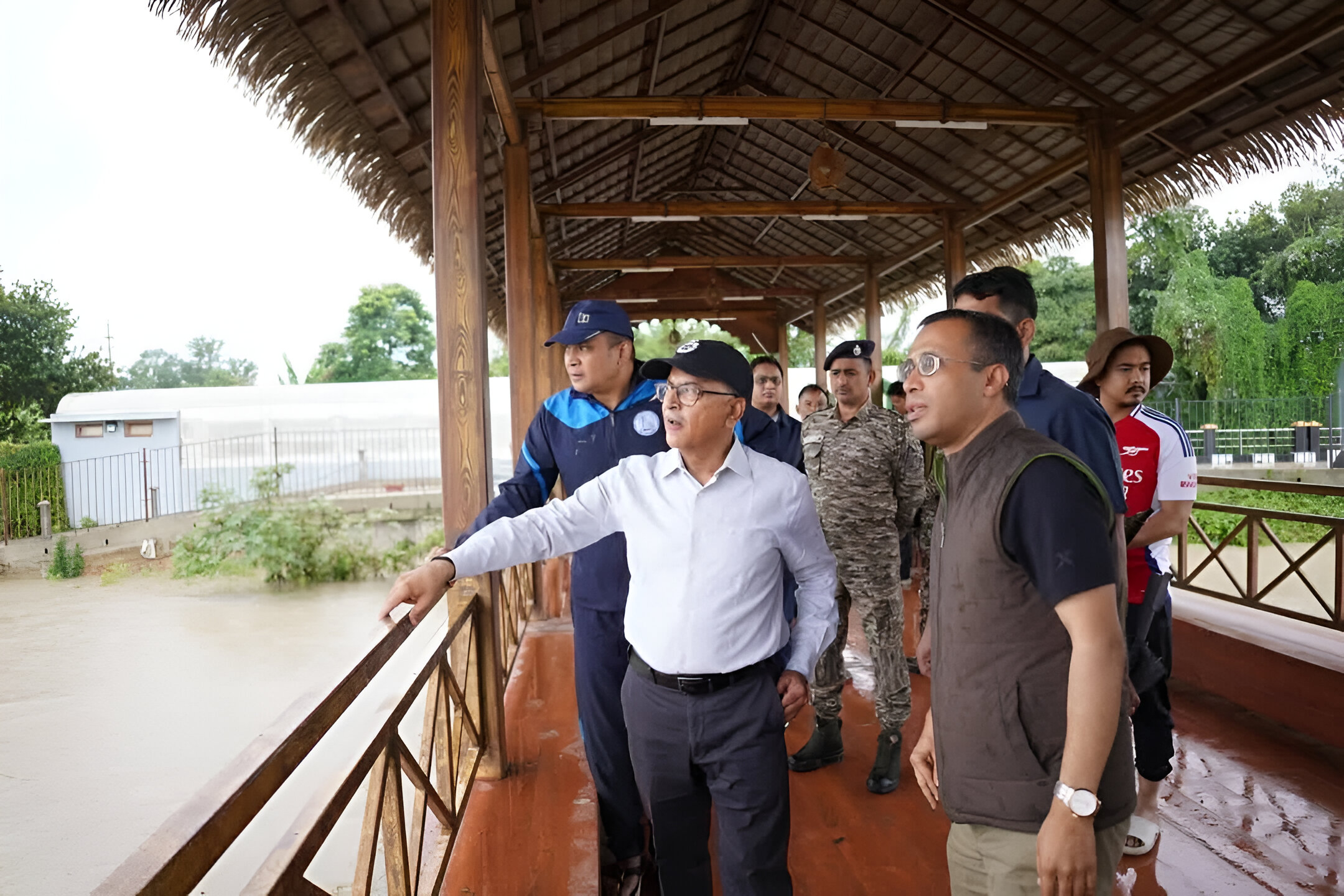
On May 31, 2025, Manipur’s capital, Imphal, faced severe flooding due to relentless rainfall, especially in Kangpokpi district. Governor Ajay Kumar Bhalla promptly visited the affected areas, including Kangla Nongpok Thong, Lairikyengbam Leikai, and Singjamei Bridge, to assess the situation. He directed officials to remain vigilant, prepare evacuation plans, and establish temporary relief camps. The State Disaster Response Force (SDRF) and National Disaster Response Force (NDRF) have been placed on standby to assist in relief operations.
Imphal Underwater: A Deep Dive into the Flood Crisis
1. The Deluge Begins
Over the past 72 hours, Kangpokpi district recorded an alarming 175 mm of rainfall, with 123 mm falling within just 24 hours between May 30 and 31. This unprecedented downpour caused the Imphal River to breach critical levels, leading to widespread flooding in Imphal city.
2. Governor’s Ground Assessment
In response to the escalating crisis, Governor Ajay Kumar Bhalla conducted an early morning visit to the flood-affected areas. Accompanied by senior officials, he assessed key locations along the Imphal River to evaluate the extent of inundation. He emphasized the importance of a swift and coordinated response, instructing Deputy Commissioners to prepare evacuation plans and establish temporary relief camps for residents at risk.
3. Emergency Measures in Place
The SDRF and NDRF units have been put on standby as part of precautionary efforts. Authorities have assured that all necessary steps are being taken to mitigate the crisis as rainfall continues across parts of the state.
FAQs
Q1: What caused the flooding in Imphal?
A: The flooding was primarily due to heavy rainfall in Kangpokpi district, which caused the Imphal River to breach critical levels.
Q2: What measures are being taken to assist affected residents?
A: Authorities have set up temporary relief camps, and the SDRF and NDRF are on standby to assist in evacuation and relief operations.
Q3: Which areas in Imphal are most affected?
A: Key areas along the Imphal River, including Kangla Nongpok Thong, Lairikyengbam Leikai, and Singjamei Bridge, have been significantly impacted.
Q4: How can residents stay informed about the situation?
A: Residents are advised to follow official channels and local news outlets for regular updates and advisories.
Q5: What long-term measures are being considered to prevent future floods?
A: Authorities are looking into improving infrastructure, implementing early warning systems, and enhancing community preparedness to mitigate future flood risks.