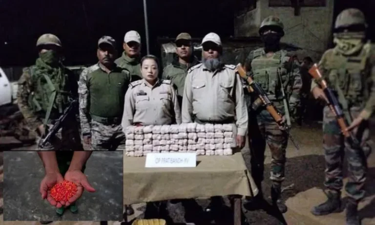
Satellite Imagery Proves It: Ex‑Manipur CM Defends Anti‑Poppy Drive Amid Deforestation Reports
Summary of the News Article
Satellite imagery from the Manipur Remote Sensing Applications Centre (MARSAC), covering late 2023 and early 2024, confirms a sharp reduction in opium poppy cultivation—dropping from nearly 28,600 acres in 2021–22 to approximately 11,300 acres in 2023–24, a 60% decline While former Chief Minister N. Biren Singh hailed this “War on Drugs” campaign as evidence of effective action, environmental activists warn that aggressive poppy eradication may be driving deforestation and soil degradation—a side effect that needs more scrutiny
Introduction
Ever wondered how farmland secretly transforms? In Manipur’s hills, opium poppy used to loom large—then satellite eyes caught it all. The result? A major shift. Let’s unpack how the “War on Drugs” is reshaping the landscape, and what the fallout might mean for forests, communities, and everyone concerned.
What MARSAC Discovered: Data from Space
A Dramatic Decline in Poppy Fields
- 28,599 acres in 2021–22 → 16,890 acres in 2022–23 → 11,288 acres in 2023–24
That’s a staggering 60% drop in just three years - MARSAC’s remote sensing breakthrough: sourcing data from ISRO’s LISS‑IV, Sentinel‑2A, Landsat 7—multiple satellites, multiple seasons.
This robust monitoring ensures accuracy across crop cycles
Targeted Districts & Ground Verification
- Nine hill districts remain hotspots: Chandel, Churachandpur, Kamjong, Kangpokpi, Noney, Senapati, Tamenglong, Tengnoupal, and Ukhrul
- Ground inspections corroborate satellite findings via GPS coordinates of 455 known poppy patches
Ex‑CM Biren Singh Speaks Up
Biren Singh, the former Chief Minister who launched the drive in 2017, says satellite data proves success. He highlights:
- A fall of 60% in cultivation within three years.
- Over 19,000 acres destroyed since 2017.
- That this aligns with a ‘war on drugs’ that combines technology, enforcement, and community surveillance
He argues the state’s approach is working—and now has measurable evidence.
The Other Side: Environmental Alarm Bells
Deforestation & Soil Damage
- A May 2025 Sangai Express report warns of 11,288 acres still under poppy across 141 clusters—but notes farms are pushed into more remote forests
- MARSAC itself acknowledges that “deforestation due to mass poppy cultivation has led to adverse impacts”—including soil erosion, biodiversity loss, and falling water tables
Stats on Habitat Loss
- Between 1987 and 2022, Manipur lost 883.3 km² of forest cover—with a staggering 91% of that loss in the past six years, coinciding with intensified poppy farming
FAQs
Q1: How reliable is satellite imagery for tracking poppy farming?
Very reliable—MARSAC uses multi-sensor data (LISS‑IV, Sentinel‑2A, Landsat 7), ground checks, and GPS mapping. It captures crop signatures across seasons
Q2: Why is deforestation tied to poppy cultivation?
Farmers clear remote forests for year-round poppy farming. Unlike shifting cultivation, poppy fields stay, eroding soil and reducing forest cover
Q3: Are there legal actions about this?
Yes—a PIL was filed in March 2022. In February 2025, the High Court advised forming a monitoring committee; but implementing it is still pending
Q4: What alternatives exist for farmers?
The state has offered alternative crops, but they yield much less income. Experts say sustainable, profitable alternatives and market linkages are essential
Q5: What should happen next?
Combine poppy eradication with ecological restoration—like tree planting, water recharge, pesticide monitoring. Also, ensure local communities gain from sustainable development.