Centre Announces New Highway Linking Myanmar Border with Mizoram, Nagaland, and Manipur
The Indo–Myanmar Border Road Project – a roughly 658 km alignment along the India–Myanmar border – has been officially declared a new National Highway, connecting the border with the states of Mizoram, Nagaland and Manipur. This announcement was made by Ajay Tamta, Minister of State for Road Transport & Highways, during his visit to Imphal. The move is part of a broader strategy to improve connectivity in the Northeast and enhance trade and security links with Myanmar.
In a recent address in Imphal, Minister Ajay Tamta revealed that the government is moving ahead with declaring the Indo–Myanmar Border Road Project — spanning approximately 658 km — as a National Highway.
He also outlined several related upgrades:
• In Manipur: upgrading the routes from Ukhrul to Jessami (NH-202, 156 km), Mao to Imphal (NH-02, 97 km), Maram to Peren (NH-129A, 104 km).
• A four-lane Greenfield alignment between Mao and Senapati via the National Highways Infrastructure Development Corporation Ltd. (NHIDCL).
• Several other corridors like Imphal–Jiribam (NH-37), Yaingangpokpi–Finch Corner (NH-202), Tamenglong–Mahur (NH-137) are targeted for completion by FY 2025-26.
For Manipur – The upgrade means previously hilly and remote districts will see better all-weather connectivity. Locals stand to gain from jobs during construction, improved access to markets, and easier travel. On the flip side, land acquisition, forest clearances, and local ecological/tribal sensitivities will need handling.
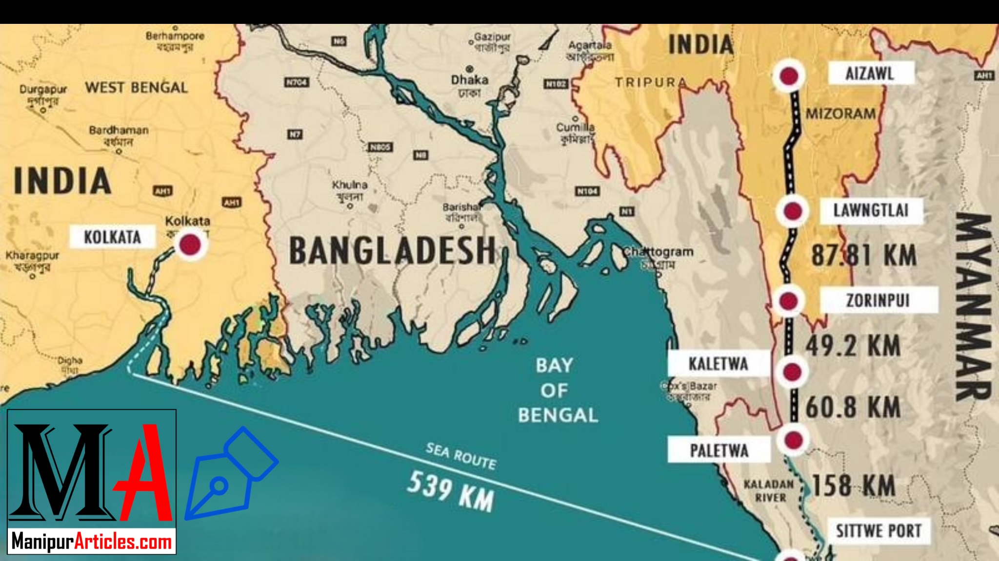
For Mizoram & Nagaland – The announcement re-affirms their inclusion in large-scale connectivity plans. For Mizoram especially, roads linking to Myanmar and through the Kaladan corridor have been in the works.
For border villages & communities – Better roads mean improved access to healthcare, education, and markets. But they also bring challenges: increased traffic, land use change, possibility of external influence, disruption of local cultures and ecosystems.